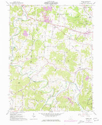
1975 Map of Rodney
USGS Topo · Published 1977About this map
Raccoon Creek carves a winding path through the center of this rural Gallia County landscape, dictating the placement of early settlements and roads. By the mid-1970s, the region retained a high density of small community centers like Adamsville, Rodney, and Northup, many connected by narrow valley routes such as Adamsville Road and Northup Road. This survey highlights the local industrial activity with prominent Strip Mines and several Claypits clustered in the northern hills. Genealogy researchers will find significant value in the numerous family and community landmarks, including the Hulbert Cem, Fairfield Ch, and the Pleasant Hill School. The southwestern corner is anchored by the Wayne National Forest, while the northeastern edge is served by the Chesapeake and Ohio railroad corridor near Kerr, showcasing a landscape of ridge-top farms and valley-bottom coal and clay operations.
Find a feature on this map
108 named features on this map. Tap any name to fly to it.
Don’t see what you’re looking for? This feature index may not catch every label — zoom into the map to look around manually.
Map Details
Editions of this 1975 Rodney Map
This is the sole edition of this map. No revisions or reprints were ever made.
Other maps of this area

1906 · Bidwell
USGS Topo · 1:62,500

1906 · Athalia
USGS Topo · 1:62,500

1906 · Glenwood
USGS Topo · 1:62,500

1908 · Bidwell
USGS Topo · 1:62,500

1908 · Athalia
USGS Topo · 1:62,500

1908 · Glenwood
USGS Topo · 1:62,500

1908 · Point Pleasant
USGS Topo · 1:62,500

1926 · Point Pleasant
USGS Topo · 1:62,500

1929 · Point Pleasant
USGS Topo · 1:62,500

1957 · Huntington
USGS Topo · 1:250,000