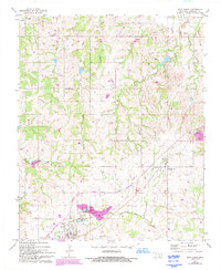
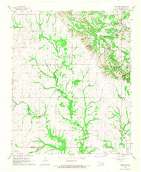
1967 Map of Roff North
USGS Topo · Published 1993About this map
Fitzhugh and the northern edge of Roff anchor this Pontotoc County landscape, which transitions from the northern drainages of Canadian Sandy Creek to the southern reach of the Blue River. The map documents a period of modern infrastructure expansion, specifically marking the Chickasaw Turnpike as a toll road then under construction. This transportation corridor cuts through a rural terrain defined by small family-named watersheds like West Days Creek and Rodtky Creek. Genealogy researchers will find several localized landmarks, including the West Hill Cem and East Hill Cem, alongside rural congregations such as Wilson Ch and Lightning Ridge Ch. The presence of numerous sandpits and gravel pits suggests a localized economy tied to aggregate extraction and road building during this era.
Find a feature on this map
22 named features on this map. Tap any name to fly to it.
Don’t see what you’re looking for? This feature index may not catch every label — zoom into the map to look around manually.
Map Details
Editions of this 1967 Roff North Map
3 editions found
Other maps of this area

1901 · Stonewall
USGS Topo · 1:125,000

1957 · Ardmore
USGS Topo · 1:250,000

1958 · Ada
USGS Topo · 1:24,000

1963 · Ardmore
USGS Topo · 1:250,000

1967 · Roff South
USGS Topo · 1:24,000

1967 · Ahloso
USGS Topo · 1:24,000
1967 · Vanoss
USGS Topo · 1:24,000
1967 · Stratford
USGS Topo · 1:24,000

1967 · Roff North
USGS Topo · 1:24,000
1967 · Fittstown
USGS Topo · 1:24,000