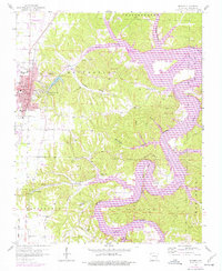
1958 Map of Rogers
USGS Topo · Published 1977About this map
The growing city of Rogers sits at the edge of a shifting landscape where the St Louis - San Francisco railroad and industrial infrastructure meet the expanding waters of the White River valley. This 1958 survey, updated with 1976 aerial data, captures a significant era of transition as the creation of Beaver Lake reshaped the Ozark terrain. The map records the historic resort area of Monte Ne and its nearby namesake Monte Ne Shores, alongside the rugged winding drainages of Esculapia Hollow and Dream Valley. To the west, the urban core of Rogers is detailed with its High Sch, North Side Sch, and the Rogers Municipal Airport (Carter Field). Genealogists can locate several family and local burial grounds, including Mullins Cem near McElhaney Bend and the Frisco Springs Cem tucked away in the southern hills near Frisco.
Find a feature on this map
57 named features on this map. Tap any name to fly to it.
Don’t see what you’re looking for? This feature index may not catch every label — zoom into the map to look around manually.
Map Details
Editions of this 1958 Rogers Map
4 editions found

Other maps of this area

1899 · Fayetteville
USGS Topo · 1:125,000

1900 · Eureka Springs
USGS Topo · 1:125,000

1901 · Eureka Springs
USGS Topo · 1:125,000

1901 · Fayetteville
USGS Topo · 1:125,000

1904 · Fayetteville
USGS Topo · 1:125,000

1945 · Harrison
USGS Topo · 1:250,000

1949 · Harrison
USGS Topo · 1:250,000

1954 · Harrison
USGS Topo · 1:250,000

1954 · Tulsa
USGS Topo · 1:250,000

1957 · War Eagle
USGS Topo · 1:24,000