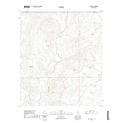
2020 Map of Rogillioville
USGS Topo · Published 2020About this map
Thompson Creek meanders along the boundary of West and East Feliciana Parishes, carving out the fertile Hickman Bottom before heading south. This rural landscape in the Florida Parishes of Louisiana is defined by a network of drainage systems, including Hurricane Cr, Beaver Cr, and Redwood Cr, which have shaped the settlement patterns around Rogillioville and Norwood. The terrain is marked by numerous family and community burial grounds, such as Pisgah Cem, McQueen Cem, and Pilgrims Rest Cem, providing a clear record of local lineage in this agricultural region. Transportation in the area relies on a grid of parish roads and lanes, including Peterson RD and Holly Ridge RD, while the Sydal Acres Airport serves as a modern waypoint. The town of Wilson sits at the southeastern edge, near where multiple creek forks converge in the wooded bottomlands.
Find a feature on this map
56 named features on this map. Tap any name to fly to it.
Don’t see what you’re looking for? This feature index may not catch every label — zoom into the map to look around manually.
Map Details
Editions of this 2020 Rogillioville Map
This is the sole edition of this map. No revisions or reprints were ever made.
Other maps of this area

1906 · Bayou Sara
USGS Topo · 1:125,000

1936 · Woodville
USGS Topo · 1:62,500

1939 · St. Francisville
USGS Topo · 1:62,500

1941 · Norwood
USGS Topo · 1:31,680

1941 · Lost Creek
USGS Topo · 1:31,680

1945 · Norwood
USGS Topo · 1:31,680

1945 · Jackson
USGS Topo · 1:31,680

1945 · Lost Creek
USGS Topo · 1:31,680

1946 · Clinton
USGS Topo · 1:31,680

1953 · Natchez
USGS Topo · 1:250,000