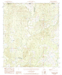
1984 Map of Rogillioville
USGS Topo · Published 1985About this map
Thompson Creek defines the sinuous boundary between West Feliciana and East Feliciana Parishes on this mid-1980s survey of the Louisiana-Mississippi borderlands. The landscape is characterized by a dense network of tributaries including Cypress Creek, Sallie Branch, and the swampy lowlands of Hickman Bottom. While much of the terrain is dominated by these wooded waterways, the eastern edge of the map shows the transition toward rural centers. The community of Wilson is situated near the Illinois Central Gulf railroad line, a critical transport corridor for the region's timber and agricultural output. To the west, the smaller settlement of Rogillioville serves as a local landmark. The presence of several unmarked Cem sites across the rolling hills suggests small family burials or older community churchyards that have served the parish residents for generations.
Find a feature on this map
23 named features on this map. Tap any name to fly to it.
Don’t see what you’re looking for? This feature index may not catch every label — zoom into the map to look around manually.
Map Details
Editions of this 1984 Rogillioville Map
This is the sole edition of this map. No revisions or reprints were ever made.
Other maps of this area

1906 · Bayou Sara
USGS Topo · 1:125,000

1936 · Woodville
USGS Topo · 1:62,500

1939 · St. Francisville
USGS Topo · 1:62,500

1941 · Norwood
USGS Topo · 1:31,680

1941 · Lost Creek
USGS Topo · 1:31,680

1945 · Norwood
USGS Topo · 1:31,680

1945 · Jackson
USGS Topo · 1:31,680

1945 · Lost Creek
USGS Topo · 1:31,680

1946 · Clinton
USGS Topo · 1:31,680

1953 · Natchez
USGS Topo · 1:250,000