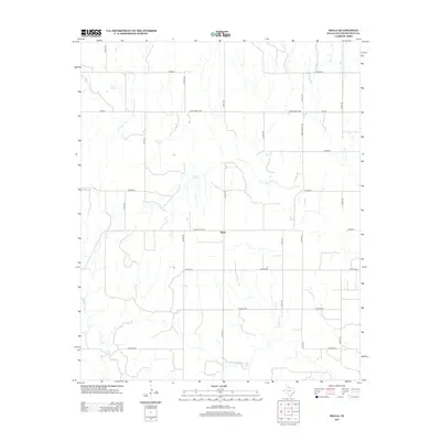
2012 Map of Rolla
USGS Topo · Published 2012About this map
Rolla sits at the junction of several county roads in this portion of Collingsworth County, where the landscape is defined by the ephemeral drainages of the eastern Texas Panhandle. The drainage of Buck Cr meanders across the central and northern sections of the map, while Wet Salt Cr cuts through the southwestern corner. These watercourses are vital landmarks in a largely agricultural region characterized by a rectilinear grid of transit routes, including Ranch Road 338 and Fm-338. Near the northern boundary, Roscoe Springs offers a specific point of geographic interest in an area otherwise dominated by the expansive ranching and farming tracts typical of the High Plains. The network of numbered county roads, such as Co Road V and Co Rd 130, illustrates the modern connectivity of this rural community in the early twenty-first century.
Find a feature on this map
24 named features on this map. Tap any name to fly to it.
Don’t see what you’re looking for? This feature index may not catch every label — zoom into the map to look around manually.
Map Details
Editions of this 2012 Rolla Map
This is the sole edition of this map. No revisions or reprints were ever made.
Other maps of this area

1954 · Plainview
USGS Topo · 1:250,000

1958 · Plainview
USGS Topo · 1:250,000

1959 · Wellington NW
USGS Topo · 1:24,000

1960 · Loco
USGS Topo · 1:62,500

1961 · Estelline
USGS Topo · 1:62,500

1964 · Rolla SW
USGS Topo · 1:24,000

1964 · Rolla NE
USGS Topo · 1:24,000

1964 · Wellington
USGS Topo · 1:24,000

1964 · Quail
USGS Topo · 1:24,000

1964 · Rolla
USGS Topo · 1:24,000