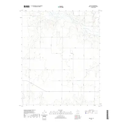
2019 Map of Rolla NE
USGS Topo · Published 2019About this map
The Salt Fork Red River carves a complex, braided path across the northern reaches of this Collingsworth County landscape, defining the local hydrology alongside Cottonwood Cr and Lake Cr. This section of the Texas Panhandle is characterized by a sparse, organized grid of rural corridors, where state routes like FM 1981 and FM 2344 intersect with an extensive network of county roads such as Co RD M and Co RD 110. A notable geographic landmark, Wischkaemper Springs, sits just south of the river bluffs, suggesting a localized source of water that historically influenced land use in this semi-arid environment. The terrain transitions from the river valley's alluvial flats to the higher elevations of the surrounding plains, documented here with high-resolution detail that shows the persistent relationship between the river's drainage and the agricultural layout of the region.
Find a feature on this map
21 named features on this map. Tap any name to fly to it.
Don’t see what you’re looking for? This feature index may not catch every label — zoom into the map to look around manually.
Map Details
Editions of this 2019 Rolla NE Map
This is the sole edition of this map. No revisions or reprints were ever made.
Other maps of this area

1954 · Amarillo
USGS Topo · 1:250,000

1954 · Plainview
USGS Topo · 1:250,000

1958 · Amarillo
USGS Topo · 1:250,000

1958 · Plainview
USGS Topo · 1:250,000

1959 · Wellington NW
USGS Topo · 1:24,000

1964 · Rolla SW
USGS Topo · 1:24,000

1964 · Rolla NE
USGS Topo · 1:24,000

1964 · Wellington
USGS Topo · 1:24,000

1964 · Quail
USGS Topo · 1:24,000
1964 · Abra
USGS Topo · 1:24,000