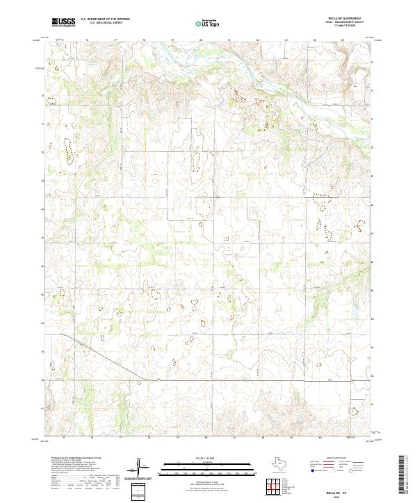
2022 Map of Rolla NE
USGS Topo · Published 2022About this map
The Salt Fork Red River meanders across the northern reaches of this Collingsworth County landscape, defining the local hydrology alongside Wischkaemper Springs and Cottonwood Cr. This modern survey by the U.S. Geological Survey illustrates a rural Texas Panhandle environment where the settlement pattern is dictated by an organized grid of county roads. Primary transit corridors like Fm 1981 and Fm 2344 intersect with numerous numbered routes such as Co Rd 110 and Co Rd 150, facilitating movement between agricultural properties. The topography is marked by the distinct drainage systems feeding into the Red River basin, providing a detailed look at the contemporary land divisions and water sources in this portion of the eastern Panhandle.
Find a feature on this map
20 named features on this map. Tap any name to fly to it.
Don’t see what you’re looking for? This feature index may not catch every label — zoom into the map to look around manually.
Map Details
Editions of this 2022 Rolla NE Map
This is the sole edition of this map. No revisions or reprints were ever made.
Other maps of this area

1954 · Amarillo
USGS Topo · 1:250,000

1954 · Plainview
USGS Topo · 1:250,000

1958 · Amarillo
USGS Topo · 1:250,000

1958 · Plainview
USGS Topo · 1:250,000

1959 · Wellington NW
USGS Topo · 1:24,000

1964 · Rolla SW
USGS Topo · 1:24,000

1964 · Rolla NE
USGS Topo · 1:24,000

1964 · Wellington
USGS Topo · 1:24,000

1964 · Quail
USGS Topo · 1:24,000
1964 · Abra
USGS Topo · 1:24,000