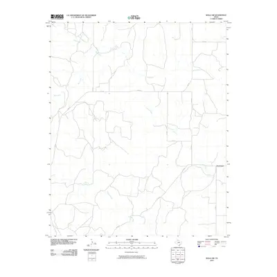
2010 Map of Rolla SW
USGS Topo · Published 2010About this map
Swearingen anchors the southeastern corner of this rural Texas landscape, where the drainage systems of several key waterways define the local topography. The map illustrates a distinctive network of seasonal and permanent watercourses, including the divergent paths of Wet Salt Creek and Dry Salt Creek, which carve through the plains. The northern reaches are dominated by Buck Creek and its tributary Squaw Creek, indicating a terrain heavily influenced by hydraulic erosion and ranching needs. The human footprint is primarily defined by a geometric grid of rural transit, with major local arteries like FM 1547 and FM 1056 providing the essential connections between remote farmsteads and regional markets. This 2010 survey highlights the enduring isolation and vast scale of the Collingsworth County panhandle, where land division and road placement continue to follow the natural logic of the creek beds and flat prairies.
Find a feature on this map
13 named features on this map. Tap any name to fly to it.
Don’t see what you’re looking for? This feature index may not catch every label — zoom into the map to look around manually.
Map Details
Editions of this 2010 Rolla SW Map
This is the sole edition of this map. No revisions or reprints were ever made.
Other maps of this area

1954 · Plainview
USGS Topo · 1:250,000

1958 · Plainview
USGS Topo · 1:250,000

1959 · McKnight
USGS Topo · 1:24,000

1961 · Memphis
USGS Topo · 1:62,500

1961 · Estelline
USGS Topo · 1:62,500

1963 · Giles
USGS Topo · 1:24,000

1964 · Rolla SW
USGS Topo · 1:24,000

1964 · Rolla NE
USGS Topo · 1:24,000

1964 · Quail
USGS Topo · 1:24,000

1964 · Rolla
USGS Topo · 1:24,000