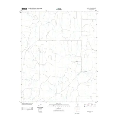
2012 Map of Rolla SW
USGS Topo · Published 2012About this map
Swearingen stands as the primary named settlement in this corner of Collingsworth County, situated along a grid of rural routes that facilitate movement through the Panhandle's drainage basins. The landscape is defined by the carved paths of Dry Salt Cr and Wet Salt Cr, which converge and wind across the plains alongside Buck Cr and Squaw Cr. This 2012 survey illustrates a region where local transportation is dominated by a systematic network of county roads and state-maintained ranch roads, including Fm-1547 and Ranch Road 1056. The placement of Ranch Road 338 near the eastern edge reflects the modern infrastructure supporting the ranching operations and isolated homesteads of this high plains environment.
Find a feature on this map
16 named features on this map. Tap any name to fly to it.
Don’t see what you’re looking for? This feature index may not catch every label — zoom into the map to look around manually.
Map Details
Editions of this 2012 Rolla SW Map
This is the sole edition of this map. No revisions or reprints were ever made.
Other maps of this area

1954 · Plainview
USGS Topo · 1:250,000

1958 · Plainview
USGS Topo · 1:250,000

1959 · McKnight
USGS Topo · 1:24,000

1961 · Memphis
USGS Topo · 1:62,500

1961 · Estelline
USGS Topo · 1:62,500

1963 · Giles
USGS Topo · 1:24,000

1964 · Rolla SW
USGS Topo · 1:24,000

1964 · Rolla NE
USGS Topo · 1:24,000

1964 · Quail
USGS Topo · 1:24,000

1964 · Rolla
USGS Topo · 1:24,000