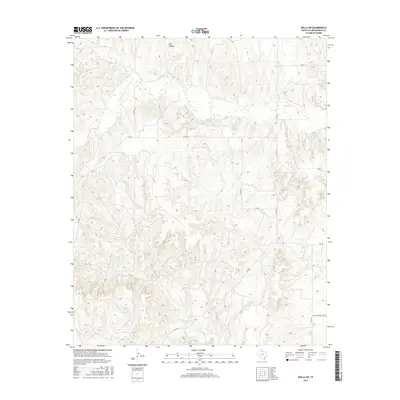
2016 Map of Rolla SW
USGS Topo · Published 2016About this map
Intermittent watercourses define the landscape of this corner of Collingsworth County, where Buck Cr and Wet Salt Cr carve through the terrain. The map reveals a sparse, rural infrastructure dominated by a grid of farm-to-market roads and county routes such as FM 1547 and Co Rd 40. These roads connect isolated ranching or farming properties in a region characterized by its drainage patterns, including the distinct Dry Hollow and the winding path of Dry Salt Cr. One of the few designated commercial landmarks in this section is the CO RD Shopping Center, located in the southeastern quadrant. This survey reflects the late-twentieth and early-twenty-first-century layout of the Texas Panhandle, showing how modern transportation routes like FM 338 have been superimposed over the natural topography of the Squaw Cr basin.
Find a feature on this map
16 named features on this map. Tap any name to fly to it.
Don’t see what you’re looking for? This feature index may not catch every label — zoom into the map to look around manually.
Map Details
Editions of this 2016 Rolla SW Map
This is the sole edition of this map. No revisions or reprints were ever made.
Other maps of this area

1954 · Plainview
USGS Topo · 1:250,000

1958 · Plainview
USGS Topo · 1:250,000

1959 · McKnight
USGS Topo · 1:24,000

1961 · Memphis
USGS Topo · 1:62,500

1961 · Estelline
USGS Topo · 1:62,500

1963 · Giles
USGS Topo · 1:24,000

1964 · Rolla SW
USGS Topo · 1:24,000

1964 · Rolla NE
USGS Topo · 1:24,000

1964 · Quail
USGS Topo · 1:24,000

1964 · Rolla
USGS Topo · 1:24,000