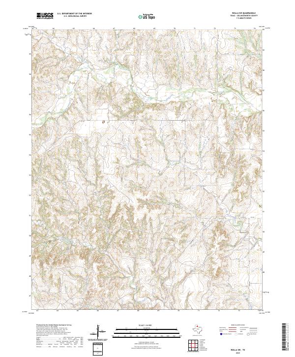
2023 Map of Rolla SW
USGS Topo · Published 2023About this map
Buck Creek and its tributaries dominate the drainage patterns of this corner of Collingsworth County, carving a network of breaks and draws through the Texas Panhandle landscape. The map illustrates a rural area defined by extensive county road grids and ranch access, where Buck Creek is joined by Little Buck Creek in the north, while the southern reaches are shaped by the intermittent flows of Wet Salt Creek and Dry Salt Creek. This 2023 survey by the U.S. Geological Survey details the infrastructure of the contemporary cattle and agricultural economy, showing the connectivity provided by Farm to Market Roads such as FM 1547 and FM 338. The absence of dense settlements emphasizes the wide-open character of the region, where family-run operations are linked by a meticulous network of local routes including Co RD 80 and Co RD 40.
Find a feature on this map
15 named features on this map. Tap any name to fly to it.
Don’t see what you’re looking for? This feature index may not catch every label — zoom into the map to look around manually.
Map Details
Editions of this 2023 Rolla SW Map
This is the sole edition of this map. No revisions or reprints were ever made.
Other maps of this area

1954 · Plainview
USGS Topo · 1:250,000

1958 · Plainview
USGS Topo · 1:250,000

1959 · McKnight
USGS Topo · 1:24,000

1961 · Memphis
USGS Topo · 1:62,500

1961 · Estelline
USGS Topo · 1:62,500

1963 · Giles
USGS Topo · 1:24,000

1964 · Rolla SW
USGS Topo · 1:24,000

1964 · Rolla NE
USGS Topo · 1:24,000

1964 · Quail
USGS Topo · 1:24,000

1964 · Rolla
USGS Topo · 1:24,000