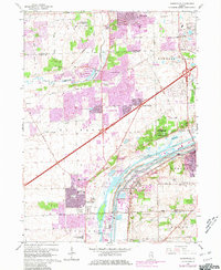
1962 Map of Romeoville
USGS Topo · Published 1981About this map
Bolingbrook and Woodridge represent the shifting landscape of mid-century suburban expansion on this sheet, which is revised with purple overlays from the late 1970s. The northern sections transition from the Hinterlong Forest Preserve into residential blocks, while the southern reaches remain defined by the industrial corridor of the Des Plaines River and the Ship Canal. This industrial belt is a hub of heavy transport, featuring the Atchison Topeka and Santa Fe and Gulf Mobile and Ohio railroads serving various quarries and the Lockport Industrial zone.
Find a feature on this map
61 named features on this map. Tap any name to fly to it.
Don’t see what you’re looking for? This feature index may not catch every label — zoom into the map to look around manually.
Map Details
Editions of this 1962 Romeoville Map
4 editions found
Other maps of this area

1890 · Des Plaines
USGS Topo · 1:62,500

1891 · Riverside
USGS Topo · 1:62,500

1892 · Joliet
USGS Topo · 1:62,500

1893 · Riverside
USGS Topo · 1:62,500

1894 · Des Plaines
USGS Topo · 1:62,500

1900 · Des Plaines
USGS Topo · 1:62,500

1900 · Riverside
USGS Topo · 1:62,500

1901 · Des Plaines
USGS Topo · 1:62,500

1901 · Riverside
USGS Topo · 1:62,500

1908 · Wheaton
USGS Topo · 1:62,500