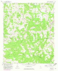
1964 Map of Roopville
USGS Topo · Published 1983About this map
Roopville sits at a crossroads in the western Georgia uplands, serving as a focal point for the agricultural communities spanning the Carroll Co Heard Co line. The landscape is defined by the winding course of the Tallapoosa R and the Little Tallapoosa River, which dictate the drainage patterns of numerous named tributaries like Indian Creek and Gum Creek. This early 1960s survey, with early 1980s photorevisions, reveals a dispersed settlement pattern centered on rural institutions.
Find a feature on this map
48 named features on this map. Tap any name to fly to it.
Don’t see what you’re looking for? This feature index may not catch every label — zoom into the map to look around manually.
Map Details
Editions of this 1964 Roopville Map
2 editions found
Other maps of this area

1889 · Tallapoosa
USGS Topo · 1:125,000

1892 · Tallapoosa
USGS Topo · 1:125,000

1897 · Tallapoosa
USGS Topo · 1:125,000

1899 · Wedowee
USGS Topo · 1:125,000

1902 · Wedowee
USGS Topo · 1:125,000

1953 · Atlanta
USGS Topo · 1:250,000

1957 · Atlanta
USGS Topo · 1:250,000

1958 · Atlanta
USGS Topo · 1:250,000

1958 · Carrollton
USGS Topo · 1:62,500

1964 · Roopville
USGS Topo · 1:24,000