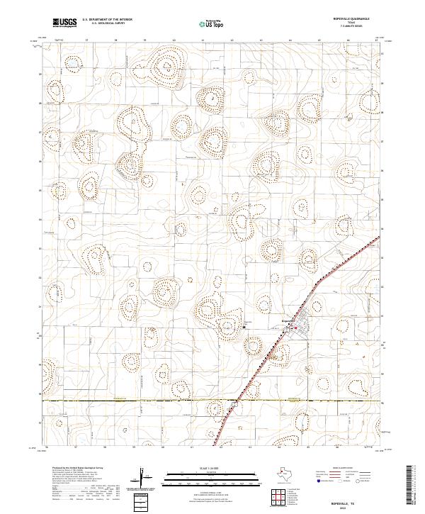
2022 Map of Ropesville
USGS Topo · Published 2022About this map
Ropesville serves as the primary hub of this Llano Estacado landscape, where a grid of rural roads named for animals and birds intersects the agricultural expanse. The town is situated at the junction of several key routes, including Fm 168 and Fm 41, with its local street grid featuring Timmons Ave and Ellington Ave. The presence of the Ropesville Cem on the outskirts provides a point of interest for genealogists tracing local families in this portion of the Texas Panhandle.
Find a feature on this map
44 named features on this map. Tap any name to fly to it.
Don’t see what you’re looking for? This feature index may not catch every label — zoom into the map to look around manually.
Map Details
Editions of this 2022 Ropesville Map
This is the sole edition of this map. No revisions or reprints were ever made.
Other maps of this area

1954 · Brownfield
USGS Topo · 1:250,000

1957 · Meadow
USGS Topo · 1:62,500

1957 · Wolfforth
USGS Topo · 1:62,500

1958 · Brownfield
USGS Topo · 1:250,000

1962 · Brownfield
USGS Topo · 1:250,000

1965 · Levelland East
USGS Topo · 1:24,000

1965 · Lockettville
USGS Topo · 1:24,000

1969 · Sundown SE
USGS Topo · 1:24,000

1976 · Wolfforth SE
USGS Topo · 1:24,000
1976 · Meadow NE
USGS Topo · 1:24,000