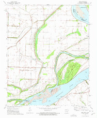
1972 Map of Rosa
USGS Topo · Published 1975About this map
The Mississippi River dominates this mid-1970s survey of the borderlands between Arkansas and Tennessee, revealing an intricate network of waterways and managed drainage. The landscape is defined by the sharp contrast between the river's active channel—featuring Canadian Reach and O'Donnell Bend—and the engineered system of canals such as Ditch No 12 and Ditch No 32 that drain the fertile bottomlands. Small settlements like Rosa and Tomato serve as focal points for the agricultural community, while the presence of family-named sites like Mann Cem and Hatchie Cem provides a clear record of local lineage in Mississippi County. The river’s shifting geography is evident in the numerous islands and towheads, including Tellier Island, Forked Deer Island, and Fletcher Towhead, alongside several historic river access points like Ashport Landing and Daniels Point Landing that once facilitated transport along this vital corridor.
Find a feature on this map
33 named features on this map. Tap any name to fly to it.
Don’t see what you’re looking for? This feature index may not catch every label — zoom into the map to look around manually.
Map Details
Editions of this 1972 Rosa Map
2 editions found
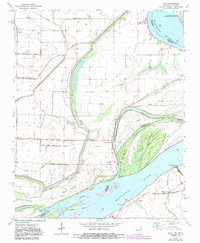
Other maps of this area

1939 · Hales Point
USGS Topo · 1:62,500

1939 · Blytheville
USGS Topo · 1:62,500

1952 · Hales Point
USGS Topo · 1:62,500

1955 · Blytheville
USGS Topo · 1:62,500

1956 · Blytheville
USGS Topo · 1:250,000

1959 · Blytheville
USGS Topo · 1:250,000

1961 · Hales Point
USGS Topo · 1:62,500

1961 · Rialto
USGS Topo · 1:62,500

1962 · Rialto
USGS Topo · 1:62,500

1962 · Hales Point
USGS Topo · 1:62,500