1973 Map of Rosamond
USGS Topo · Published 1977About this map
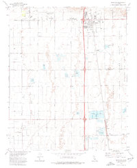
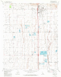
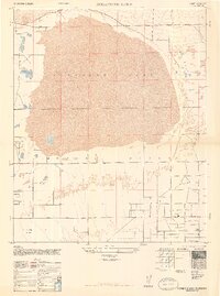
Rosamond serves as the focal point of this Mojave Desert landscape, situated along the Southern Pacific railroad line during a period of significant regional infrastructure development. The map details the residential expansion of the town, specifically near Rosamond High Sch and the Rosamond Airport. To the east, the boundary of Edwards Air Force Base is clearly delineated, showing a Tracking Station and the designated flight test base area. This geography is defined by a grid of agricultural and industrial roads such as Gaskell Road and West Avenue A, which navigate a terrain marked by numerous Duck Ponds and substantial water infrastructure including Sewage Disposal Ponds. The presence of Amargosa Creek and the settlement of Oban to the south illustrate the connectivity between the railroad corridor and the arid basin floor.
Find a feature on this map
29 named features on this map. Tap any name to fly to it.
Don’t see what you’re looking for? This feature index may not catch every label — zoom into the map to look around manually.
Map Details
Editions of this 1973 Rosamond Map
2 editions found
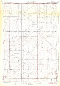
Other maps of this area

1915 · Elizabeth Lake
USGS Topo · 1:125,000

1917 · Elizabeth Lake
USGS Topo · 1:125,000

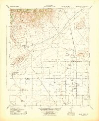
1930 · Oban
USGS Topo · 1:24,000
1931 · Esperanza School
USGS Topo · 1:24,000
1933 · Oban
USGS Topo · 1:24,000
1934 · Esperanza School
USGS Topo · 1:24,000
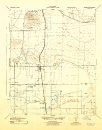
1943 · Rosamond
USGS Topo · 1:62,500
1943 · Willow Springs
USGS Topo · 1:62,500
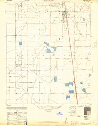
1947 · Rosamond
USGS Topo · 1:24,000
1947 · Rosamond Lake
USGS Topo · 1:24,000