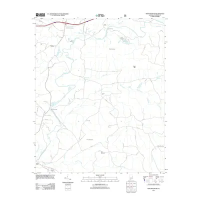
2011 Map of Ross Mountain
USGS Topo · Published 2011About this map
The Tallapoosa River winds through the heart of this Cleburne County landscape, serving as a focal point for settlement and infrastructure. This region is characterized by a series of prominent peaks, including Ross Mountain, Kemp Mountain, and Bald Mountain, which dictate the winding paths of the local road network. The map reveals a community-centered geography anchored by the Beason Mill and several historical burial grounds such as New Harmony Cemetery and Evans Cemetery. Multiple crossings like Ross Bridge and Denman Bridge link the small settlements of Belltown and Gold Hill across the river's path. To the south, the terrain descends toward the confluence of Lockchelooge Creek and the Chulafinnee Creek, where Riddles Bridge provides a vital passage. The presence of Lake Cleburne and its accompanying Lake Cleburne Dam indicates mid-century water management efforts that shaped the local hydrography.
Find a feature on this map
76 named features on this map. Tap any name to fly to it.
Don’t see what you’re looking for? This feature index may not catch every label — zoom into the map to look around manually.
Map Details
Editions of this 2011 Ross Mountain Map
This is the sole edition of this map. No revisions or reprints were ever made.
Other maps of this area

1889 · Tallapoosa
USGS Topo · 1:125,000

1891 · Ashland
USGS Topo · 1:125,000

1892 · Tallapoosa
USGS Topo · 1:125,000

1897 · Tallapoosa
USGS Topo · 1:125,000

1899 · Wedowee
USGS Topo · 1:125,000

1900 · Anniston
USGS Topo · 1:125,000

1902 · Wedowee
USGS Topo · 1:125,000

1953 · Atlanta
USGS Topo · 1:250,000

1954 · Choccolocco
USGS Topo · 1:24,000

1957 · Atlanta
USGS Topo · 1:250,000