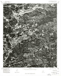
1975 Map of Ross Mountain
USGS Topo · Published 1977About this map
The Tallapoosa River meanders through the northern and western reaches of this Cleburne County landscape, serving as a primary geographical anchor for the region. This 1975 orthophotoquad, produced by the Geological Survey and the Soil Conservation Service, uses aerial imagery to reveal the physical character of the land just before the late 1970s. The small settlement of Belltown is visible along the river's path, showing the concentrated patterns of rural habitation and agriculture that contrast with the heavily wooded elevations of Ross Mountain. This specific photographic record is valuable for tracing land-use transitions, showing the exact footprint of forest clearings and road networks that were established by the mid-1970s.
Find a feature on this map
3 named features on this map. Tap any name to fly to it.
Don’t see what you’re looking for? This feature index may not catch every label — zoom into the map to look around manually.
Map Details
Editions of this 1975 Ross Mountain Map
This is the sole edition of this map. No revisions or reprints were ever made.
Other maps of this area

1889 · Tallapoosa
USGS Topo · 1:125,000

1891 · Ashland
USGS Topo · 1:125,000

1892 · Tallapoosa
USGS Topo · 1:125,000

1897 · Tallapoosa
USGS Topo · 1:125,000

1899 · Wedowee
USGS Topo · 1:125,000

1900 · Anniston
USGS Topo · 1:125,000

1902 · Wedowee
USGS Topo · 1:125,000

1953 · Atlanta
USGS Topo · 1:250,000

1954 · Choccolocco
USGS Topo · 1:24,000

1957 · Atlanta
USGS Topo · 1:250,000