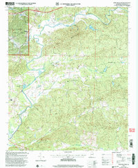
2001 Map of Ross Mountain
USGS Topo · Published 2004About this map
The Tallapoosa River carves a winding path through the northern reaches of this Cleburne County landscape, where the high ridges of Ross Mountain overlook a complex network of creeks. In the early 2000s, this area remained defined by its rural character and the presence of the Talladega National Forest along its western edge. Small communities like Arbacoochee and Belltown serve as focal points for a region shaped by timber and water. The map records a dense collection of country churches including New Harmony Ch, Greens Chapel, and Oak Hill Ch, reflecting a social landscape tied to localized congregations.
Find a feature on this map
24 named features on this map. Tap any name to fly to it.
Don’t see what you’re looking for? This feature index may not catch every label — zoom into the map to look around manually.
Map Details
Editions of this 2001 Ross Mountain Map
This is the sole edition of this map. No revisions or reprints were ever made.
Other maps of this area

1889 · Tallapoosa
USGS Topo · 1:125,000

1891 · Ashland
USGS Topo · 1:125,000

1892 · Tallapoosa
USGS Topo · 1:125,000

1897 · Tallapoosa
USGS Topo · 1:125,000

1899 · Wedowee
USGS Topo · 1:125,000

1900 · Anniston
USGS Topo · 1:125,000

1902 · Wedowee
USGS Topo · 1:125,000

1953 · Atlanta
USGS Topo · 1:250,000

1954 · Choccolocco
USGS Topo · 1:24,000

1957 · Atlanta
USGS Topo · 1:250,000