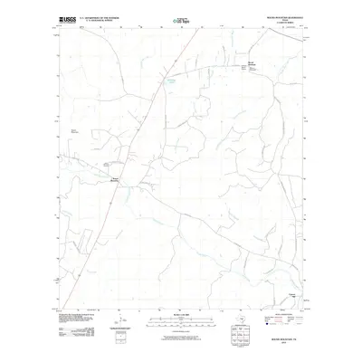
2010 Map of Round Mountain
USGS Topo · Published 2010About this map
Round Mountain serves as the focal point of this Central Texas landscape, situated at the intersection of several ranch-to-market routes and historic local roads. The settlement is anchored by the Round Mountain Cemetery, while the broader terrain is defined by a network of drainage systems including Cypress Creek, North Cypress Creek, and Cleveland Branch. To the northeast, the topographic prominence of Shovel Mountain stands near the Herbert Ranch Airport, marking a shift in the local elevation. The mapping reveals a rural infrastructure built around large-scale ranching and private aviation, with numerous named family roads like Crofts Family Rd and Winnie Smith Rd providing access to the interior. Small water bodies like Mustang Lake and the various branches of Flatrock Creek highlight the importance of water management in this limestone-heavy terrain. Near the southeastern corner, the small community of Cypress Mill reflects the region's historic dependence on local milling and water resources.
Find a feature on this map
34 named features on this map. Tap any name to fly to it.
Don’t see what you’re looking for? This feature index may not catch every label — zoom into the map to look around manually.
Map Details
Editions of this 2010 Round Mountain Map
This is the sole edition of this map. No revisions or reprints were ever made.
Other maps of this area

1887 · Blanco
USGS Topo · 1:125,000

1887 · Burnet
USGS Topo · 1:125,000

1893 · Burnet
USGS Topo · 1:125,000

1894 · Blanco
USGS Topo · 1:125,000

1903 · Burnet
USGS Topo · 1:125,000

1909 · Burnet
USGS Topo · 1:125,000

1925 · Burnet 3-d
USGS Topo · 1:48,000

1929 · Marble Falls
USGS Topo · 1:62,500

1931 · Marble Falls
USGS Topo · 1:48,000

1932 · Marble Falls
USGS Topo · 1:62,500