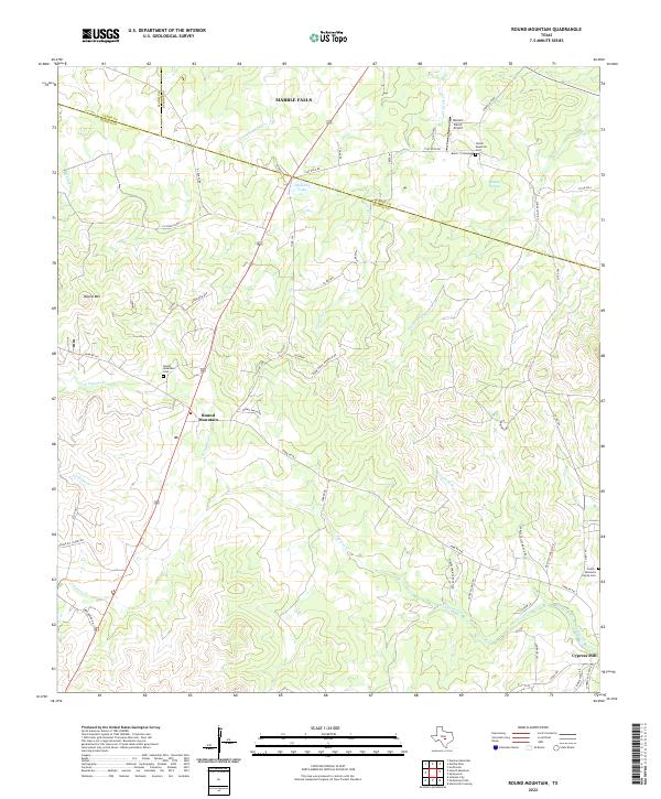
2022 Map of Round Mountain
USGS Topo · Published 2022About this map
Round Mountain and Cypress Mill anchor the rugged landscape of this Hill Country region where Blanco, Burnet, and Llano counties converge. The terrain is defined by the prominent peak of Round Mountain and a network of waterways including Double Horn Creek and North Cypress Creek. The map reveals a land held by long-standing ranching traditions, evidenced by family-named landmarks and private airfields such as the Herbert Ranch Airport.
Find a feature on this map
56 named features on this map. Tap any name to fly to it.
Don’t see what you’re looking for? This feature index may not catch every label — zoom into the map to look around manually.
Map Details
Editions of this 2022 Round Mountain Map
This is the sole edition of this map. No revisions or reprints were ever made.
Other maps of this area

1887 · Blanco
USGS Topo · 1:125,000

1887 · Burnet
USGS Topo · 1:125,000

1893 · Burnet
USGS Topo · 1:125,000

1894 · Blanco
USGS Topo · 1:125,000

1903 · Burnet
USGS Topo · 1:125,000

1909 · Burnet
USGS Topo · 1:125,000

1925 · Burnet 3-d
USGS Topo · 1:48,000

1929 · Marble Falls
USGS Topo · 1:62,500

1931 · Marble Falls
USGS Topo · 1:48,000

1932 · Marble Falls
USGS Topo · 1:62,500