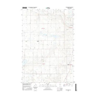
2016 Map of Round Prairie
USGS Topo · Published 2016About this map
The Long Prairie River meanders through the northeast corner of this central Minnesota landscape, defining the topography near the settlement of Round Prairie. This 2016 survey illustrates a largely agricultural and wetland-rich environment in Todd County, where small communities like Gutches Grove are linked by a grid of rural roads and section lines. Notable for local historians and genealogists, the map identifies the Reynolds Cem situated near Keller Lake. The terrain is punctuated by numerous water bodies, including McCarrahan Lake, Maple Lake, and Mud Lake, reflecting the glacial legacy of the region. Aviation history is represented by Todd Field located just south of the main township area, while historical transport routes are preserved through labels like Ginseng Rd and Midway Rd.
Find a feature on this map
36 named features on this map. Tap any name to fly to it.
Don’t see what you’re looking for? This feature index may not catch every label — zoom into the map to look around manually.
Map Details
Editions of this 2016 Round Prairie Map
This is the sole edition of this map. No revisions or reprints were ever made.
Other maps of this area

1953 · Brainerd
USGS Topo · 1:250,000

1953 · Saint Cloud
USGS Topo · 1:250,000

1957 · Brainerd
USGS Topo · 1:250,000

1957 · Saint Cloud
USGS Topo · 1:250,000

1958 · Saint Cloud
USGS Topo · 1:250,000

1958 · Brainerd
USGS Topo · 1:250,000

1965 · Brainerd
USGS Topo · 1:250,000

1966 · West Union
USGS Topo · 1:24,000
1966 · Browerville
USGS Topo · 1:24,000
1966 · Sauk Lake
USGS Topo · 1:24,000