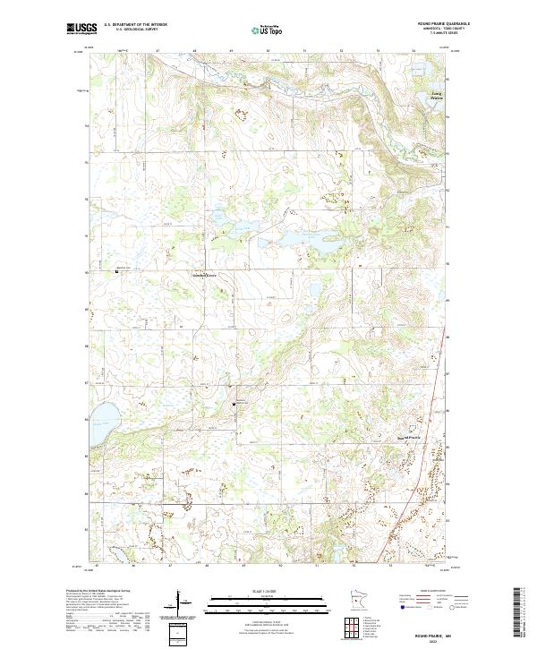
2022 Map of Round Prairie
USGS Topo · Published 2022About this map
The Long Prairie River and its tributary wind through this agricultural landscape in central Minnesota, defining the drainage patterns for the surrounding townships. The small community of Gutches Grove and the namesake Round Prairie serve as local landmarks in an area characterized by numerous glacial water bodies, including the significant Keller Lake and McCarrahan Lake. Genealogists and local historians can locate the Reynolds Cem and the nearby Reynolds Baptist Cem, providing valuable points of reference for tracing family roots in the region. Near the eastern edge, Todd Field stands as a notable modern landmark. The map illustrates a dense network of county and local roads, such as Co RD 86, Co 10, and Co 36, which connect the scattered farmsteads and rural settlements that have long shaped the cultural and economic character of this prairie region.
Find a feature on this map
39 named features on this map. Tap any name to fly to it.
Don’t see what you’re looking for? This feature index may not catch every label — zoom into the map to look around manually.
Map Details
Editions of this 2022 Round Prairie Map
This is the sole edition of this map. No revisions or reprints were ever made.
Other maps of this area

1953 · Brainerd
USGS Topo · 1:250,000

1953 · Saint Cloud
USGS Topo · 1:250,000

1957 · Brainerd
USGS Topo · 1:250,000

1957 · Saint Cloud
USGS Topo · 1:250,000

1958 · Saint Cloud
USGS Topo · 1:250,000

1958 · Brainerd
USGS Topo · 1:250,000

1965 · Brainerd
USGS Topo · 1:250,000

1966 · West Union
USGS Topo · 1:24,000
1966 · Browerville
USGS Topo · 1:24,000
1966 · Sauk Lake
USGS Topo · 1:24,000