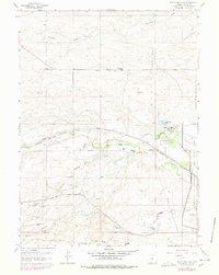
1961 Map of Round Top Lake
USGS Topo · Published 1978About this map
The Francis E Warren Air Force Base boundary marks the eastern edge of this landscape, where the high plains transition into a specialized agricultural and water-management corridor. Significant infrastructure is centered near the namesake Round Top Lake, including a Pumping Sta, a Filtration Plant, and the expansive Department of Agriculture Horticultural Field Station. These features reflect a mid-century focus on scientific agriculture and municipal water supply serving the nearby Cheyenne area.
Find a feature on this map
50 named features on this map. Tap any name to fly to it.
Don’t see what you’re looking for? This feature index may not catch every label — zoom into the map to look around manually.
Map Details
Editions of this 1961 Round Top Lake Map
4 editions found
Other maps of this area

1905 · Sherman
USGS Topo · 1:125,000

1911 · Cheyenne
USGS Topo · 1:125,000

1914 · Cheyenne
USGS Topo · 1:125,000

1950 · Cheyenne
USGS Topo · 1:62,500

1954 · Cheyenne
USGS Topo · 1:250,000

1958 · Cheyenne
USGS Topo · 1:250,000

1961 · Round Top Lake
USGS Topo · 1:24,000

1961 · Cheyenne South
USGS Topo · 1:24,000
1961 · Borie
USGS Topo · 1:24,000

1961 · Cheyenne
USGS Topo · 1:62,500