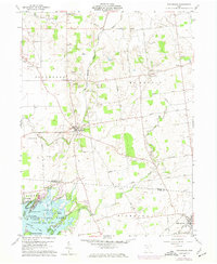
1960 Map of Roundhead
USGS Topo · Published 1974About this map
The Virginia Military District Boundary cuts a distinctive diagonal across this landscape, separating the irregular land claims to the east from the township grid to the west. At the center of the sheet, Roundhead sits at the junction of the upper Scioto River and a network of county roads including the historic Military Road. This 1960s-era survey captures the rural character of Hardin County before significant modernization, showing a landscape defined by small family cemeteries such as Bowdle Cem and Rutledge Cem, and local social centers like Mt Zion Ch. To the south, the northern reaches of Indian Lake are visible, featuring an intricate cluster of named islands including Ewing Island, Pony Island, and Seminole Island. The presence of the Nickell Landing Field and numerous gravel pits suggests the local aviation and extractive industries of the mid-20th century.
Find a feature on this map
51 named features on this map. Tap any name to fly to it.
Don’t see what you’re looking for? This feature index may not catch every label — zoom into the map to look around manually.
Map Details
Editions of this 1960 Roundhead Map
Other maps of this area

1913 · Alger
USGS Topo · 1:48,000

1913 · Bellefontaine
USGS Topo · 1:48,000

1913 · East Liberty
USGS Topo · 1:62,500

1915 · Alger
USGS Topo · 1:62,500

1915 · Bellefontaine
USGS Topo · 1:62,500

1915 · East Liberty
USGS Topo · 1:62,500

1915 · Kenton
USGS Topo · 1:62,500

1943 · Alger
USGS Topo · 1:62,500

1944 · East Liberty
USGS Topo · 1:62,500

1944 · Kenton
USGS Topo · 1:62,500