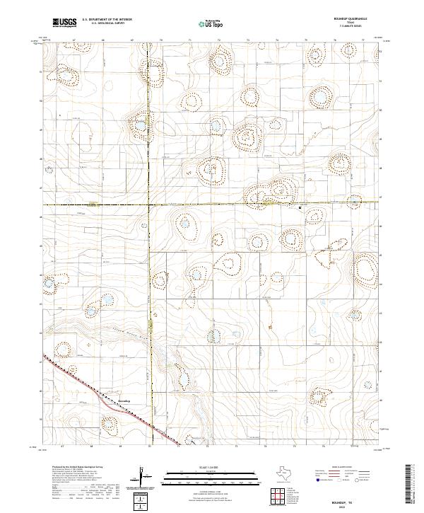
2022 Map of Roundup
USGS Topo · Published 2022About this map
The small community of Roundup sits at the intersection of rural highways and local farm roads, marking a classic High Plains settlement pattern where the landscape is defined by the geometry of county boundaries. This quadrangle captures the junction of four counties — Lamb, Hale, Hockley, and Lubbock — a rare geographical quadruple point situated near the County Line Cem. The terrain is characterized by the meandering path of Yellow House Draw, which provides the primary topographic variation in an otherwise flat expanse of agricultural parcels and industrial-scale land management.
Find a feature on this map
42 named features on this map. Tap any name to fly to it.
Don’t see what you’re looking for? This feature index may not catch every label — zoom into the map to look around manually.
Map Details
Editions of this 2022 Roundup Map
This is the sole edition of this map. No revisions or reprints were ever made.
Other maps of this area

1954 · Lubbock
USGS Topo · 1:250,000

1954 · Brownfield
USGS Topo · 1:250,000

1956 · Shallowater
USGS Topo · 1:24,000

1957 · Lubbock
USGS Topo · 1:62,500

1957 · Anton
USGS Topo · 1:62,500

1957 · Abernathy
USGS Topo · 1:62,500

1957 · Wolfforth
USGS Topo · 1:62,500

1958 · Brownfield
USGS Topo · 1:250,000

1962 · Brownfield
USGS Topo · 1:250,000
1976 · Anton SW
USGS Topo · 1:24,000