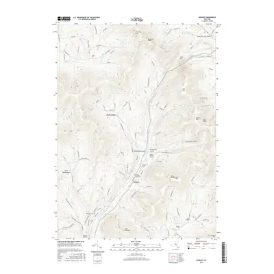
2016 Map of Roxbury
USGS Topo · Published 2016About this map
The East Branch Delaware River carves a deep valley through the heart of this landscape, defining the layout of the settlement at Roxbury. In the mid-2010s, this region retains its character through clustered hamlets and narrow hollows, such as Moffit Settlement Hollow and Meeker Hollow, that follow the natural contours of the Catskill terrain. The drainage patterns of Town Brook and Batavia Kill dictate the placement of mountain roads and the historic pockets of local industry, while landmarks like the Roxbury Runway Airport suggest the modern adaptation of these high-altitude flats.
Find a feature on this map
102 named features on this map. Tap any name to fly to it.
Don’t see what you’re looking for? This feature index may not catch every label — zoom into the map to look around manually.
Map Details
Editions of this 2016 Roxbury Map
This is the sole edition of this map. No revisions or reprints were ever made.
Other maps of this area

1900 · Phoenicia
USGS Topo · 1:62,500

1901 · Margaretville
USGS Topo · 1:62,500

1901 · Gilboa
USGS Topo · 1:62,500

1903 · Gilboa
USGS Topo · 1:62,500

1903 · Phoenicia
USGS Topo · 1:62,500

1904 · Hobart
USGS Topo · 1:62,500

1904 · Margaretville
USGS Topo · 1:62,500

1945 · West Kill
USGS Topo · 1:24,000

1945 · Gilboa
USGS Topo · 1:24,000

1945 · Fleischmanns
USGS Topo · 1:24,000