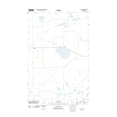
2011 Map of Roy Lake
USGS Topo · Published 2011About this map
Mahkonce and the settlement at Roy Lake define the human footprint on this northern Minnesota landscape within the White Earth Reservation. The area is characterized by an intricate network of glacial lakes and wetlands, including Tamarack Lake, Norris Lake, and the uniquely shaped Horseshoe Lake. The topography is punctuated by modest elevations like Hogback Hill and Jack Pine Hill, which rise above the surrounding creek basins.
Find a feature on this map
36 named features on this map. Tap any name to fly to it.
Don’t see what you’re looking for? This feature index may not catch every label — zoom into the map to look around manually.
Map Details
Editions of this 2011 Roy Lake Map
This is the sole edition of this map. No revisions or reprints were ever made.
Other maps of this area

1954 · Bemidji
USGS Topo · 1:250,000

1957 · Bemidji
USGS Topo · 1:250,000

1958 · Bemidji
USGS Topo · 1:250,000

1969 · North Twin Lake
USGS Topo · 1:24,000

1969 · Ebro
USGS Topo · 1:24,000

1969 · Roy Lake
USGS Topo · 1:24,000

1969 · Tulaby Lake
USGS Topo · 1:24,000

1969 · Snider Lake
USGS Topo · 1:24,000
1969 · Ebro NW
USGS Topo · 1:24,000

1969 · Long Lost Lake
USGS Topo · 1:24,000