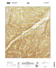
2019 Map of Ruby A-4 NE
USGS Topo · Published 2019About this map
Lost River meanders across this interior landscape within the Yukon-Koyukuk Census Area, defining the drainage patterns of a region shaped by high-latitude hydrology. The terrain is structured by the Public Land Survey System, specifically within the townships of t14s r21e, t15s r21e, and t16s r21e, reflecting the systematic grid applied to the Alaskan wilderness. In the northwest corner, Bonanza Cr cuts through the elevations, its name suggesting the prospecting history common to this part of the Alaska interior. This 2019 data release from the U.S. Geological Survey utilizes high-resolution elevation datasets and imagery to record the precise contours of the valleys and ridgelines that separate these watercourses.
Find a feature on this map
8 named features on this map. Tap any name to fly to it.
Don’t see what you’re looking for? This feature index may not catch every label — zoom into the map to look around manually.
Map Details
Editions of this 2019 Ruby A-4 NE Map
This is the sole edition of this map. No revisions or reprints were ever made.
Other maps of this area

1951 · Ruby
USGS Topo · 1:250,000

1952 · Ruby A-3
USGS Topo · 1:63,360

1952 · Ruby A-4
USGS Topo · 1:63,360

1952 · Ruby B-4
USGS Topo · 1:63,360

1952 · Ruby B-3
USGS Topo · 1:63,360

1952 · Ruby
USGS Topo · 1:250,000
1953 · Ruby B-3
USGS Topo · 1:63,360

1964 · Ruby
USGS Topo · 1:250,000
2019 · Ruby A-4 NW
USGS Topo · 1:25,000
2019 · Ruby A-3 NW
USGS Topo · 1:25,000