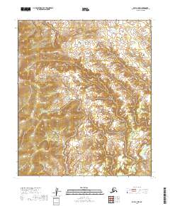
2019 Map of Ruby C-1 NW
USGS Topo · Published 2019About this map
Highlands within the Yukon-Koyukuk Census Area dominate this 2019 survey, where the drainages of the interior Alaskan wilderness are captured in meticulous topographic detail. The terrain is defined by a dense network of ridges and valleys, with the waters of Grand Cr flowing through the southeastern portion of the quadrangle. The map primarily documents the complex topography and public land survey boundaries, including t9s r27e and t10s r28e, without the presence of established roads or permanent settlements. This data, produced by the U.S. Geological Survey, serves as a foundational record of the remote interior landscape as it existed in the early 21st century, providing essential geographic context for this undeveloped region.
Find a feature on this map
8 named features on this map. Tap any name to fly to it.
Don’t see what you’re looking for? This feature index may not catch every label — zoom into the map to look around manually.
Map Details
Editions of this 2019 Ruby C-1 NW Map
This is the sole edition of this map. No revisions or reprints were ever made.
Other maps of this area

1951 · Ruby
USGS Topo · 1:250,000

1952 · Ruby C-1
USGS Topo · 1:63,360

1952 · Ruby D-1
USGS Topo · 1:63,360

1952 · Ruby C-2
USGS Topo · 1:63,360

1952 · Ruby D-2
USGS Topo · 1:63,360

1952 · Ruby
USGS Topo · 1:250,000

1964 · Ruby
USGS Topo · 1:250,000
2019 · Ruby C-1 SE
USGS Topo · 1:25,000
2019 · Ruby D-1 SW
USGS Topo · 1:25,000
2019 · Ruby D-2 SE
USGS Topo · 1:25,000