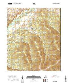
2019 Map of Ruby C-2 SW
USGS Topo · Published 2019About this map
The Little Mud River winds through this interior landscape within the Yukon-Koyukuk region. The terrain is characterized by complex hydrology, where the river's path is marked by numerous meanders and oxbow lakes, a typical pattern for this part of the Alaskan wilderness. This area, surveyed during the late 2010s, showcases the intersection of several township and range boundaries including t10s r24e, t11s r25e, and t10s r26e. The lack of named settlements or infrastructure highlight the territory's remote character, where the natural drainage of the Little Mud River serves as the primary geographical marker for those studying the region's physical geography or local land use history.
Find a feature on this map
7 named features on this map. Tap any name to fly to it.
Don’t see what you’re looking for? This feature index may not catch every label — zoom into the map to look around manually.
Map Details
Editions of this 2019 Ruby C-2 SW Map
This is the sole edition of this map. No revisions or reprints were ever made.
Other maps of this area

1951 · Ruby
USGS Topo · 1:250,000

1952 · Ruby B-2
USGS Topo · 1:63,360

1952 · Ruby C-3
USGS Topo · 1:63,360

1952 · Ruby C-2
USGS Topo · 1:63,360

1952 · Ruby B-3
USGS Topo · 1:63,360

1952 · Ruby
USGS Topo · 1:250,000
1953 · Ruby B-3
USGS Topo · 1:63,360

1964 · Ruby
USGS Topo · 1:250,000
2019 · Ruby B-2 NW
USGS Topo · 1:25,000
2019 · Ruby C-2 SE
USGS Topo · 1:25,000