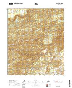
2019 Map of Ruby C-3 NE
USGS Topo · Published 2019About this map
The public land survey system grid organizes this interior landscape within the Yukon-Koyukuk Census Area of Alaska. This 2019 survey documents the complex topography of the region, defining the boundaries of townships including t9s r23e and t9s r24e. The terrain is characterized by intricate contour intervals at ten feet, revealing a network of small water bodies and varied elevations across several townships, including portions of t8s r23e, t8s r24e, t10s r23e, and t10s r24e. Because this map focuses on the physical geography and surveying lines of an undeveloped area, it is primarily a tool for understanding the land structure and hydrology of the Ruby C-3 NE quadrangle as it was recorded in the early twenty-first century. The lack of named settlements or man-made structures highlights the wilderness character of this specific sector of the Alaska interior.
Find a feature on this map
6 named features on this map. Tap any name to fly to it.
Don’t see what you’re looking for? This feature index may not catch every label — zoom into the map to look around manually.
Map Details
Editions of this 2019 Ruby C-3 NE Map
This is the sole edition of this map. No revisions or reprints were ever made.
Other maps of this area

1951 · Ruby
USGS Topo · 1:250,000

1952 · Ruby C-3
USGS Topo · 1:63,360

1952 · Ruby C-2
USGS Topo · 1:63,360

1952 · Ruby D-3
USGS Topo · 1:63,360

1952 · Ruby D-2
USGS Topo · 1:63,360

1952 · Ruby
USGS Topo · 1:250,000

1964 · Ruby
USGS Topo · 1:250,000
2019 · Ruby C-2 NW
USGS Topo · 1:25,000
2019 · Ruby C-2 SW
USGS Topo · 1:25,000
2019 · Ruby D-2 SW
USGS Topo · 1:25,000