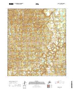
2019 Map of Ruby C-4 SE
USGS Topo · Published 2019About this map
The Sulatna River winds through this interior Alaskan wilderness, exhibiting a complex, meandering path that dominates the southern and eastern portions of the landscape. This 2019 survey by the U.S. Geological Survey illustrates the intricate hydrology of the Yukon-Koyukuk region, where the river's tight loops and oxbows suggest a low-gradient floodplain subject to seasonal shifts. In the southeast corner, the tributary Monzonite Cr joins the drainage system, providing a specific point of reference for researchers tracking watercourses in this undeveloped terrain. The map is primarily defined by its natural features and the established township and range lines of the Public Land Survey System, including t11s r21e and t10s r22e, which provide the only structural grid over the unpopulated expanse.
Find a feature on this map
6 named features on this map. Tap any name to fly to it.
Don’t see what you’re looking for? This feature index may not catch every label — zoom into the map to look around manually.
Map Details
Editions of this 2019 Ruby C-4 SE Map
This is the sole edition of this map. No revisions or reprints were ever made.
Other maps of this area

1951 · Ruby
USGS Topo · 1:250,000

1952 · Ruby C-3
USGS Topo · 1:63,360

1952 · Ruby B-4
USGS Topo · 1:63,360

1952 · Ruby B-3
USGS Topo · 1:63,360

1952 · Ruby C-4
USGS Topo · 1:63,360

1952 · Ruby
USGS Topo · 1:250,000
1953 · Ruby B-3
USGS Topo · 1:63,360

1964 · Ruby
USGS Topo · 1:250,000
2019 · Ruby C-4 NW
USGS Topo · 1:25,000
2019 · Ruby B-3 NW
USGS Topo · 1:25,000