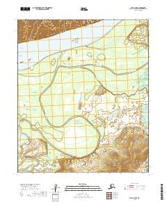
2019 Map of Ruby C-6 NW
USGS Topo · Published 2019About this map
The Yukon River dominates this northern Alaskan landscape, carving a wide path across the upper portion of the quadrangle. The river’s dynamic nature is evident in the formation of Big Island and the winding course of Ruby Slough, which meanders through the low-lying terrain south of the main channel. These waterways historically served as primary transportation corridors in the Yukon-Koyukuk region, long before modern road networks reached this interior wilderness.
Find a feature on this map
12 named features on this map. Tap any name to fly to it.
Don’t see what you’re looking for? This feature index may not catch every label — zoom into the map to look around manually.
Map Details
Editions of this 2019 Ruby C-6 NW Map
This is the sole edition of this map. No revisions or reprints were ever made.
Other maps of this area

1945 · Nulato
USGS Topo · 1:250,000

1951 · Nulato
USGS Topo · 1:250,000

1951 · Ruby
USGS Topo · 1:250,000

1952 · Nulato C-1
USGS Topo · 1:63,360

1952 · Nulato D-1
USGS Topo · 1:63,360

1952 · Ruby D-6
USGS Topo · 1:63,360

1952 · Ruby C-6
USGS Topo · 1:63,360

1952 · Nulato
USGS Topo · 1:250,000

1952 · Ruby
USGS Topo · 1:250,000

1964 · Ruby
USGS Topo · 1:250,000