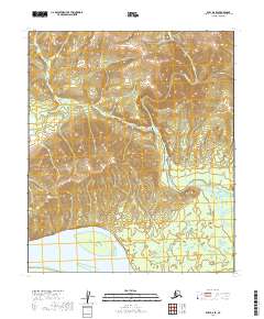
2019 Map of Ruby D-6 SE
USGS Topo · Published 2019About this map
The Yukon River dominates the southern reaches of this landscape, its wide channel and shifting gravel bars defining the drainage patterns of the northern Interior. Just north of the river, Melozi Island sits in a broad sweep of the water, a classic riverine feature of the Yukon-Koyukuk region. The topographic relief increases as the terrain moves north toward the Melozitna River, which cuts through the dramatic Melozitna Canyon. This area represents a complex network of waterways, including Grayling Cr and both Upper Nikiaremut Cr and Lower Nikiaremut Cr. The drainage patterns and sharp elevation changes at the canyon reflect a wilderness largely shaped by these major river systems rather than human industry or settlement.
Find a feature on this map
13 named features on this map. Tap any name to fly to it.
Don’t see what you’re looking for? This feature index may not catch every label — zoom into the map to look around manually.
Map Details
Editions of this 2019 Ruby D-6 SE Map
This is the sole edition of this map. No revisions or reprints were ever made.
Other maps of this area

1951 · Ruby
USGS Topo · 1:250,000

1952 · Ruby D-6
USGS Topo · 1:63,360

1952 · Ruby D-5
USGS Topo · 1:63,360

1952 · Ruby C-5
USGS Topo · 1:63,360

1952 · Ruby C-6
USGS Topo · 1:63,360

1952 · Ruby
USGS Topo · 1:250,000

1964 · Ruby
USGS Topo · 1:250,000
2019 · Ruby D-6 NE
USGS Topo · 1:25,000
2019 · Ruby D-6 SW
USGS Topo · 1:25,000
2019 · Ruby C-6 NW
USGS Topo · 1:25,000