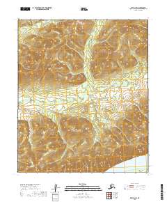
2019 Map of Ruby D-6 SW
USGS Topo · Published 2019About this map
The Yukon River dominates the southern edge of this landscape, its broad course defining the local geography as it flows past Big Island. This 2019 survey documents a largely unpeopled reach of the Alaska interior, where the primary topographic features are the winding drainage of Whakatna Cr and the rhythmic elevation changes of the surrounding hills. The absence of roads or permanent structures reflects the seasonal and remote nature of the region, focusing instead on the hydrography and public land survey divisions. The map delineates the boundaries of t7s r14e, t7s r15e, t8s r14e, and t8s r15e, providing essential reference points for land management and wilderness navigation within the Yukon-Koyukuk Census Area.
Find a feature on this map
7 named features on this map. Tap any name to fly to it.
Don’t see what you’re looking for? This feature index may not catch every label — zoom into the map to look around manually.
Map Details
Editions of this 2019 Ruby D-6 SW Map
This is the sole edition of this map. No revisions or reprints were ever made.
Other maps of this area

1945 · Nulato
USGS Topo · 1:250,000

1951 · Nulato
USGS Topo · 1:250,000

1951 · Ruby
USGS Topo · 1:250,000

1952 · Nulato C-1
USGS Topo · 1:63,360

1952 · Nulato D-1
USGS Topo · 1:63,360

1952 · Ruby D-6
USGS Topo · 1:63,360

1952 · Ruby C-6
USGS Topo · 1:63,360

1952 · Nulato
USGS Topo · 1:250,000

1952 · Ruby
USGS Topo · 1:250,000

1964 · Ruby
USGS Topo · 1:250,000