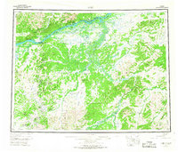
1952 Map of Ruby
USGS Topo · Published 1967About this map
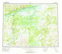
The Yukon River carves through the northern reaches of this interior Alaskan landscape, serving as the primary corridor for river navigation and settlement. The town of Ruby sits along its banks, acting as a gateway to the mining districts further south. A Telegraph Line and a Winter Trail provide the early infrastructure connecting remote outposts like Melozi and Ophir. The terrain is defined by high domes and hills, including the Kokrines Hills and Monzonite Hills, while the drainage of the Nowitna River and Sulatna River dominates the central and southern reaches.
Find a feature on this map
62 named features on this map. Tap any name to fly to it.
Don’t see what you’re looking for? This feature index may not catch every label — zoom into the map to look around manually.
Map Details
Editions of this 1952 Ruby Map
8 editions found

Other maps of this area

1945 · Nulato
USGS Topo · 1:250,000

1948 · Kantishna River
USGS Topo · 1:250,000

1950 · Medfra
USGS Topo · 1:250,000

1951 · Ophir
USGS Topo · 1:250,000

1951 · Nulato
USGS Topo · 1:250,000

1951 · Kantishna River
USGS Topo · 1:250,000

1951 · Ruby
USGS Topo · 1:250,000

1951 · Kateel River
USGS Topo · 1:250,000

1951 · Melozitna
USGS Topo · 1:250,000

1951 · Tanana
USGS Topo · 1:250,000