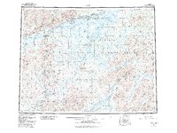
1952 Map of Ruby
USGS Topo · Published 1984About this map
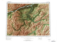
The Yukon River defines the northern reaches of this mid-century interior landscape, where the town of Ruby serves as a primary hub for the surrounding wilderness. To the south, a network of remote settlements and mining outposts like Poorman, Placerville, and Ophir are connected by the historic Telegraph Line, illustrating the era's reliance on localized communications and bush transport. The presence of Placer Mine operations along the tributaries of the Sulatna River points to the persistent legacy of gold prospecting in the region.
Find a feature on this map
50 named features on this map. Tap any name to fly to it.
Don’t see what you’re looking for? This feature index may not catch every label — zoom into the map to look around manually.
Map Details
Editions of this 1952 Ruby Map
8 editions found

Other maps of this area

1945 · Nulato
USGS Topo · 1:250,000

1948 · Kantishna River
USGS Topo · 1:250,000

1950 · Medfra
USGS Topo · 1:250,000

1951 · Ophir
USGS Topo · 1:250,000

1951 · Nulato
USGS Topo · 1:250,000

1951 · Kantishna River
USGS Topo · 1:250,000

1951 · Ruby
USGS Topo · 1:250,000

1951 · Kateel River
USGS Topo · 1:250,000

1951 · Melozitna
USGS Topo · 1:250,000

1951 · Tanana
USGS Topo · 1:250,000