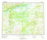
1952 Map of Ruby
USGS Topo · Published 1973About this map
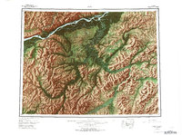
The Yukon River serves as the central artery for this remote region of central Alaska during the mid-twentieth century. Near the settlement of Ruby, the river bifurcates around Big Ruby Slough, while a Telegraph Line and a series of trails connect riverside outposts to the interior. Moving south from the main channel, the landscape transitions into the high elevations of the Kokrines Hills and Boston Dome. This period of survey reveals the remnants of interior gold-mining activity, with small settlements like Placerville, Poorman, and Ophir dotting the drainages of the Sulatna River. The presence of several Placer Mines and a Landing Area indicates the persistent reliance on both river and air transport for resource extraction. Notable navigational and land features such as Sulatna Crossing and Tamarack Bluff provided critical landmarks for those traversing the extensive river networks of the Nowitna River and its tributaries.
Find a feature on this map
111 named features on this map. Tap any name to fly to it.
Don’t see what you’re looking for? This feature index may not catch every label — zoom into the map to look around manually.
Map Details
Editions of this 1952 Ruby Map
8 editions found

Other maps of this area

1945 · Nulato
USGS Topo · 1:250,000

1948 · Kantishna River
USGS Topo · 1:250,000

1950 · Medfra
USGS Topo · 1:250,000

1951 · Ophir
USGS Topo · 1:250,000

1951 · Nulato
USGS Topo · 1:250,000

1951 · Kantishna River
USGS Topo · 1:250,000

1951 · Ruby
USGS Topo · 1:250,000

1951 · Kateel River
USGS Topo · 1:250,000

1951 · Melozitna
USGS Topo · 1:250,000

1951 · Tanana
USGS Topo · 1:250,000