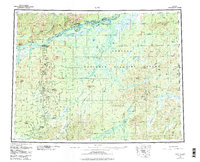
1952 Map of Ruby
USGS Topo · Published 1984About this map
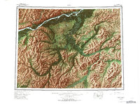
The Yukon River carves through the northern reaches of this interior Alaskan landscape, where the settlement of Ruby serves as a critical junction for river travel and regional transport. To the south, the sprawling wetlands and winding waterways of the Nowitna National Wildlife Refuge dominate the central terrain, punctuated by the Monzonite Hills and the Sischu Mountains.
Find a feature on this map
101 named features on this map. Tap any name to fly to it.
Don’t see what you’re looking for? This feature index may not catch every label — zoom into the map to look around manually.
Map Details
Editions of this 1952 Ruby Map
8 editions found

Other maps of this area

1945 · Nulato
USGS Topo · 1:250,000

1948 · Kantishna River
USGS Topo · 1:250,000

1950 · Medfra
USGS Topo · 1:250,000

1951 · Ophir
USGS Topo · 1:250,000

1951 · Nulato
USGS Topo · 1:250,000

1951 · Kantishna River
USGS Topo · 1:250,000

1951 · Ruby
USGS Topo · 1:250,000

1951 · Kateel River
USGS Topo · 1:250,000

1951 · Melozitna
USGS Topo · 1:250,000

1951 · Tanana
USGS Topo · 1:250,000