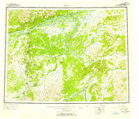
1952 Map of Ruby
USGS Topo · Published 1958About this map
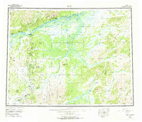
Ruby and its surrounding gold-mining districts are documented here in the early 1950s, showing a landscape defined by the drainage systems of the Yukon River and Nowitna River. The map captures the remote settlement patterns of the Fourth Judicial Division, where small outposts like Poorman, Ophir, and Placerville served as hubs for interior operations. Resource extraction is a primary feature, with multiple Placer Mine sites and a network of trails connecting the camps to river access points like Sulatna Crossing. Notable landmarks of the region include Horner Hot Springs near the Kokrines Hills and the distinctive geological formation at Monument Rocks. High-elevation landmarks such as Yuki Mountain, The Hub Mountain, and Boston Dome provide navigational references across the expansive river valleys and the winding courses of the Sischu Creek and Titna River.
Find a feature on this map
80 named features on this map. Tap any name to fly to it.
Don’t see what you’re looking for? This feature index may not catch every label — zoom into the map to look around manually.
Map Details
Editions of this 1952 Ruby Map
8 editions found

Other maps of this area

1945 · Nulato
USGS Topo · 1:250,000

1948 · Kantishna River
USGS Topo · 1:250,000

1950 · Medfra
USGS Topo · 1:250,000

1951 · Ophir
USGS Topo · 1:250,000

1951 · Nulato
USGS Topo · 1:250,000

1951 · Kantishna River
USGS Topo · 1:250,000

1951 · Ruby
USGS Topo · 1:250,000

1951 · Kateel River
USGS Topo · 1:250,000

1951 · Melozitna
USGS Topo · 1:250,000

1951 · Tanana
USGS Topo · 1:250,000