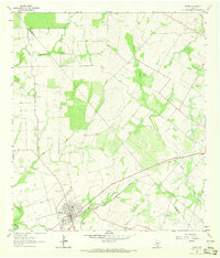
1963 Map of Runge
USGS Topo · Published 1965About this map
Runge serves as the primary hub on this mid-century survey, situated at the junction of the Southern Pacific railroad and a network of rural routes. The town’s layout includes a localized Athletic Field and a nearby Sewage Disposal facility, reflecting the infrastructure of a settled agricultural center. The surrounding landscape is defined by its drainage systems, with Ojo de Agua Creek and Ecleto Creek cutting through the terrain. To the north and east, several family-named waterways like McTennel Creek and Butler Creek suggest the early ranching and farming history of the area near the border of De Witt County and Karnes County. Notable landmarks for genealogists include the Nordheim Cemetery and several isolated Gravel Pits and Gas Wells, pointing to the region's extraction activities alongside its established rural settlements.
Find a feature on this map
18 named features on this map. Tap any name to fly to it.
Don’t see what you’re looking for? This feature index may not catch every label — zoom into the map to look around manually.
Map Details
Editions of this 1963 Runge Map
2 editions found
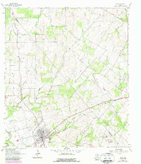
Other maps of this area

1920 · Smiley
USGS Topo · 1:125,000

1953 · Beeville
USGS Topo · 1:250,000

1953 · Seguin
USGS Topo · 1:250,000

1956 · Beeville
USGS Topo · 1:250,000

1956 · Karnes City
USGS Topo · 1:62,500

1958 · Seguin
USGS Topo · 1:250,000

1960 · Beeville
USGS Topo · 1:250,000

1960 · Helena
USGS Topo · 1:24,000
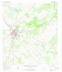
1961 · Kenedy
USGS Topo · 1:24,000

1961 · New Davy
USGS Topo · 1:24,000