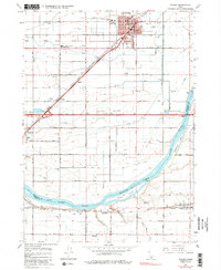
1964 Map of Rupert
USGS Topo · Published 1984About this map
Rupert serves as the focal point of this mid-century survey, anchored by its grid of schools like Lincoln Sch and Washington Sch, alongside Memorial Park and the County Fairgrounds. The landscape is defined by the highly engineered irrigation system of the Snake River Valley, where the Main Canal, Waste Canal, and various numbered drains like D-15 Drain support the region's agricultural vitality. South of the main settlement, the Snake River widens into Milner Lake, dividing the terrain with prominent features like Frenchmans Island and Parees Island.
Find a feature on this map
52 named features on this map. Tap any name to fly to it.
Don’t see what you’re looking for? This feature index may not catch every label — zoom into the map to look around manually.
Map Details
Editions of this 1964 Rupert Map
3 editions found
Other maps of this area

1954 · Pocatello
USGS Topo · 1:250,000

1958 · Pocatello
USGS Topo · 1:250,000

1964 · Rupert SE
USGS Topo · 1:24,000

1964 · Burley NE
USGS Topo · 1:24,000

1964 · View
USGS Topo · 1:24,000

1964 · Kenyon
USGS Topo · 1:24,000

1964 · Rupert NW
USGS Topo · 1:24,000

1964 · Acequia
USGS Topo · 1:24,000

1964 · Rupert SW
USGS Topo · 1:24,000

1964 · Burley SE
USGS Topo · 1:24,000