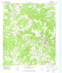
1973 Map of Rusk
USGS Topo · Published 1977About this map
The St Louis Southwestern railroad and the Texas State Railroad intersect at Rusk, the central hub of this 1970s Cherokee County landscape. The town is marked by significant institutional presence, including the expansive grounds of the Rusk State Hospital and the nearby Old Prison Cem. To the east, the terrain transitions into protected woodlands at Jim Hogg State Park and the Fairchild State Forest, while several family-named burial grounds like Jones Cem and Ford Cem are scattered across the surrounding rural areas.
Find a feature on this map
40 named features on this map. Tap any name to fly to it.
Don’t see what you’re looking for? This feature index may not catch every label — zoom into the map to look around manually.
Map Details
Editions of this 1973 Rusk Map
This is the sole edition of this map. No revisions or reprints were ever made.
Other maps of this area

1943 · Rusk
USGS Topo · 1:62,500

1945 · Rusk
USGS Topo · 1:62,500

1946 · Alto
USGS Topo · 1:62,500

1951 · Jacksonville
USGS Topo · 1:62,500

1952 · Slocum
USGS Topo · 1:62,500

1953 · Palestine
USGS Topo · 1:250,000

1957 · Palestine
USGS Topo · 1:250,000
1973 · New Summerfield
USGS Topo · 1:24,000
1973 · Jacksonville East
USGS Topo · 1:24,000
1973 · Atoy
USGS Topo · 1:24,000