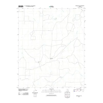
2010 Map of Russellville
USGS Topo · Published 2010About this map
Russellville serves as the focal point for this Motley County landscape, where the rural character of West Texas is defined by expansive ranching operations and a network of winding waterways. The settlement pattern is sparse, centered around the Russellville Camp and the Bird Ranch in the southern portion of the quadrangle. These sites suggest a legacy of cattle ranching that has long sustained the local economy. The terrain is deeply carved by the drainage systems of Tee Pee Creek and Hackberry Creek, which flow toward the Tongue River in the southeast corner. A grid of county roads, including Co RD 402 and Co RD 441, provides the primary infrastructure connecting these remote ranching outposts. The map illustrates a modern era of land management where traditional ranching boundaries are meticulously preserved alongside contemporary topographic data.
Find a feature on this map
13 named features on this map. Tap any name to fly to it.
Don’t see what you’re looking for? This feature index may not catch every label — zoom into the map to look around manually.
Map Details
Editions of this 2010 Russellville Map
This is the sole edition of this map. No revisions or reprints were ever made.
Other maps of this area

1954 · Lubbock
USGS Topo · 1:250,000

1954 · Plainview
USGS Topo · 1:250,000

1958 · Plainview
USGS Topo · 1:250,000

1966 · Matador
USGS Topo · 1:24,000

1966 · Ballard Camp
USGS Topo · 1:24,000

1966 · Tee Pee City
USGS Topo · 1:24,000

1968 · Roaring Springs
USGS Topo · 1:24,000

1968 · Russellville
USGS Topo · 1:24,000

1968 · Dumont
USGS Topo · 1:24,000

1968 · China Canyon
USGS Topo · 1:24,000