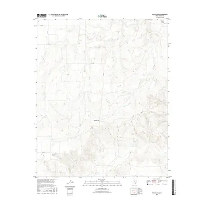
2016 Map of Russellville
USGS Topo · Published 2016About this map
Russellville serves as the central point of this West Texas landscape in the mid-2010s, situated within the rolling drainages of Motley County. The topography is defined by the winding paths of Hackberry Cr and Tee Pee Cr, which carve through the terrain to create distinctive features like Darden Canyon in the southwest. A grid of county roads, including Co RD 408 and Co RD 433, provides access across this ranching and agricultural country, reflecting the persistent rural settlement patterns of the region. The map illustrates how local infrastructure follows the natural contours of the creeks and canyons, maintaining a network that connects isolated homesteads and local landmarks throughout the quadrangle.
Find a feature on this map
12 named features on this map. Tap any name to fly to it.
Don’t see what you’re looking for? This feature index may not catch every label — zoom into the map to look around manually.
Map Details
Editions of this 2016 Russellville Map
This is the sole edition of this map. No revisions or reprints were ever made.
Other maps of this area

1954 · Lubbock
USGS Topo · 1:250,000

1954 · Plainview
USGS Topo · 1:250,000

1958 · Plainview
USGS Topo · 1:250,000

1966 · Matador
USGS Topo · 1:24,000

1966 · Ballard Camp
USGS Topo · 1:24,000

1966 · Tee Pee City
USGS Topo · 1:24,000

1968 · Roaring Springs
USGS Topo · 1:24,000

1968 · Russellville
USGS Topo · 1:24,000

1968 · Dumont
USGS Topo · 1:24,000

1968 · China Canyon
USGS Topo · 1:24,000