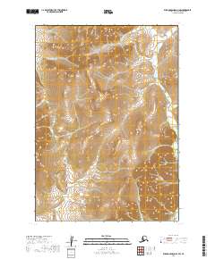
2019 Map of Russian Mission A-3 SW
USGS Topo · Published 2019About this map
Nyac sits at the base of a high-relief landscape where the headwaters of the Tuluksak River begin their winding descent. This 2019 survey of the Bethel Census Area reveals a region shaped by gold mining history, evidenced by the specific naming of drainages and topographical depressions. Steep valleys and ridges are carved by a network of waterways including Granite Cr, Sabula Cr, and Nugget Cr, which feed into the larger river system. The presence of Shovel Gulch and Mary Lou Gulch near the settlement area suggests the enduring legacy of 20th-century placer operations in the Kuskokwim Mountains. The map provides a detailed view of the terrain as it appeared during recent decades of modern resource management, showing the complex drainage patterns of the Dugout Cr and Max Cr drainages.
Find a feature on this map
13 named features on this map. Tap any name to fly to it.
Don’t see what you’re looking for? This feature index may not catch every label — zoom into the map to look around manually.
Map Details
Editions of this 2019 Russian Mission A-3 SW Map
This is the sole edition of this map. No revisions or reprints were ever made.
Other maps of this area

1947 · Russian Mission
USGS Topo · 1:250,000

1950 · Russian Mission
USGS Topo · 1:250,000

1950 · Bethel
USGS Topo · 1:250,000

1954 · Russian Mission A-4
USGS Topo · 1:63,360

1954 · Bethel D-4
USGS Topo · 1:63,360

1954 · Russian Mission A-3
USGS Topo · 1:63,360

1954 · Bethel D-3
USGS Topo · 1:63,360

1980 · Russian Mission
USGS Topo · 1:250,000

1980 · Bethel
USGS Topo · 1:250,000
2017 · Russian Mission A-4 SE
USGS Topo · 1:25,000