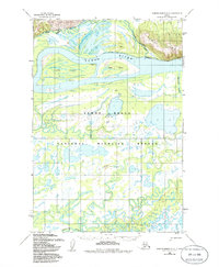
1952 Map of Russian Mission D-5
USGS Topo · Published 1986About this map
The Yukon River dominates this mid-century landscape, carving a complex network of braids and islands through the Yukon Delta. This environment is characterized by shifting waterways and landforms like Pearl Island and Base Island, which are defined by seasonal flow and sedimentation. To the northeast, the Paimiut Hills provide a stark topographical contrast to the low-lying wetlands that make up the vast majority of the Yukon Delta National Wildlife Refuge.
Find a feature on this map
19 named features on this map. Tap any name to fly to it.
Don’t see what you’re looking for? This feature index may not catch every label — zoom into the map to look around manually.
Map Details
Editions of this 1952 Russian Mission D-5 Map
2 editions found
Other maps of this area

1947 · Russian Mission
USGS Topo · 1:250,000

1950 · Russian Mission
USGS Topo · 1:250,000

1951 · Holy Cross
USGS Topo · 1:250,000

1952 · Holy Cross A-4
USGS Topo · 1:63,360

1952 · Holy Cross A-3
USGS Topo · 1:63,360

1952 · Holy Cross
USGS Topo · 1:250,000

1952 · Russian Mission D-4
USGS Topo · 1:63,360
1952 · Russian Mission D-6
USGS Topo · 1:63,360

1952 · Russian Mission C-5
USGS Topo · 1:63,360
1952 · Russian Mission D-5
USGS Topo · 1:63,360