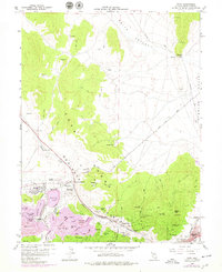
1958 Map of Ruth
USGS Topo · Published 1979About this map
Ruth and its surrounding mining operations dominate this landscape on the eastern slopes of the Egan Range during the late 1950s. The industrial footprint of copper mining is evident through massive earthworks like the Liberty Pit and the Open Pit Mine, supported by a dense network of shafts including the Deep Ruth Shaft and Monitor Shaft. The Northern Nevada railroad winds through the complex topography, connecting these ore bodies to the processing centers. Further east, the map captures the western edge of Ely, where the Central Ely Sch and Ogden Ave mark the transition from industrial extraction to residential life.
Find a feature on this map
67 named features on this map. Tap any name to fly to it.
Don’t see what you’re looking for? This feature index may not catch every label — zoom into the map to look around manually.
Map Details
Editions of this 1958 Ruth Map
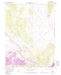
Other maps of this area

1952 · Ely
USGS Topo · 1:125,000

1956 · Ely
USGS Topo · 1:250,000

1958 · McGill
USGS Topo · 1:24,000

1958 · Ruth
USGS Topo · 1:24,000

1958 · East Ely
USGS Topo · 1:24,000

1958 · Comins Lake
USGS Topo · 1:24,000

1958 · Ely
USGS Topo · 1:62,500

1958 · McGill
USGS Topo · 1:62,500

1958 · Reipetown
USGS Topo · 1:24,000

1958 · Giroux Wash
USGS Topo · 1:24,000